Categories
- Accommodation Guides

- Calendars & Diaries
- Canoeing & Kayaking
- Caving
- Climbing
- Cycling
- Fitness Training Nutrition
- Geology
- Inland Waterways
- Journals
- Kitesurfing
- Maps
 Maps
Maps
- Africa [73]
- Asia
- Australasia
- Central America [7]
- Europe
Europe
- Albania [13]
- Austria [83]
- Azores [3]
- Balearic Islands [19]
- Canary Islands [12]
- Corsica [4]
- Crete [4]
- Croatia [6]
- Dav [48]
- Denmark [16]
- Estonia [2]
- France [17]
- France Pyrenees [23]
- France, Alps [35]
- France, Ign 1:100,000 [73]
- France, Ign 1:25,000 [274]
- France, Ign Road [20]
- General [38]
- Germany [36]
- Greece [69]
- Greece Islands [30]
- Greece, 1:25,000 [16]
- Greece, 1:50,000 [19]
- Iceland [24]
- Ireland [23]
- Italy [177]
- Kosovo [1]
- Latvia [2]
- Macedonia [1]
- Madeira [5]
- Malta [2]
- Montenegro [3]
- Norway [17]
- Norway 1:50,000 [33]
- Norway Hiking [2]
- Poland [7]
- Romania [13]
- Scandinavia [16]
- Serbia & Montenegro [14]
- Slovenia [7]
- Spain [68]
- Spain Pyrenees [50]
- Swisstopo 1:100,000 [2]
- Swisstopo 1:250,000 [4]
- Swisstopo 1:50,000 Ski [16]
- Swisstopo1:25,000 [102]
- Swisstopo1:50,000 [116]
- Switzerland [24]
- Turkey [7]
- Ireland [5]
- Middle East
- North America
- Polar
- South America
- Uk
- UK: AA Leisure 1:50 000 [5]
- UK: AA Walker's 1:25 000 [13]
- Uk: Activity
- Uk: Ordnance Survey
- Uk: Raised Relief
- World [12]
- Nautical
- Outdoor Skills
- Running
- Snow Sports
- Surfing
- Swimming
- Trail Running / Fellrunning
- Travel
- Triathlon
- Walking & Hiking
- Wildlife
- Windsports
|
Walking & Hiking » Guides » Uk Wales
Walking & Hiking » Guides » Uk, Long Distance Paths
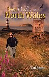
Walking the Isle of Anglesey Coastal Path
Offical Guide
£14.99
|

|
The official guide to the Isle of Anglesey Coastal Path - revised and updated in 2018.
English only edition, wholly revised with numerous additional photographs. Full colour throughout with Ordnance Survey Mapping. The route in this guide is walked in a clockwise direction.
The 130 mile/210km long Isle of Anglesey Coastal Path passes through some of the grandest coastal scenery in Wales - wide sandy bays and estuaries, intimate coves, dramatic cliffs and rocky islets, sand dunes and forests-much of it designated 'An Area of Outstanding Natural Beauty.
This Official Guide has been designed to provide all the information needed to plan and walk the coastal path and includes:
o Information on accommodation, public transport, seasonal closures and tidal restrictions
o Twelve day-walk chapter sections with detailed route descriptions and full Ordnance Survey mapping
o Fascinating notes on points of interest
Contents
o How to use this guide
o Distance chart
o The Isle of Anglesey
o A brief history of Anglesey
o A history of the coastal path
o Walking the Isle of Anglesey Coastal Path
o General access restrictions
o Safety on the Coastal Path
o Getting to the official start point
o Walking the Coastal Path and transportation
o Accommodation along the Coastal Path
o Isle of Anglesey Coastal Path
o Section 1: Holyhead to Church Bay
o Section 2: Church Bay to Cemaes
o Section 3: Cemaes to Amlwch Port
o Section 4: Amlwch Port to Moelfre
o Section 5: Moelfre to Pentraeth
o Section 6: Pentraeth to Beaumaris
o Section 7: Beaumaris to LLanfairpwll
o Section 8: LLanfairpwll to Newborough
o Section 9: Newborough to Aberffraw
o Section 10: Aberffraw to Four Mile Bridge
o Section 11: Four Mile Bridge to Trearddur
o Section 12: Trearddur to Holyhead
In Stock
Usually dispatched within 24 hrs. Free delivery to UK for orders £25 and over.
£14.99
Cordee Code: CWW218
Author: Carl Rogers
No of Pages: 160
Page Size: 115 x 190 mm
ISBN 10: 1902512154
ISBN 13: 9781902512150
Publisher: Mara Books
Published Date: February 2016
Edition: 2020 reprint
Binding: Paperback (flapped)
Illustrations: colour photos and maps
Weight: 270g
|
Other titles of interest:

In Stock
|
In Stock
|
This title has not yet been released. Pre-order now and we will deliver to you when it arrives.
Expected: 02/07/2024
|

In Stock
|

In Stock
|

In Stock
|

In Stock
|

In Stock
|

In Stock
|

In Stock
|
|
|
Click to Close [X]
 |